
Precision Farming
Drone and AI surveying significantly enhance precision farming by providing accurate, real-time data on crop health, soil conditions, and field variability. This targeted insight allows farmers to apply resources more efficiently—only where needed—reducing waste, lowering costs, and boosting yields while promoting sustainable farming practices.
Enhancing Precision Farming with Drones and Artificial Intelligence
1. Introduction
Precision farming, also known as precision agriculture, is a modern farming approach that uses data and technology to optimise crop yields, reduce input costs, and minimise environmental impact. Among the most transformative technologies in this domain are drones and artificial intelligence (AI). Together, these tools enable farmers to make informed decisions based on real-time, high-resolution data gathered from their fields.
2. Role of Drones in Precision Farming
Drones, or unmanned aerial vehicles (UAVs), are increasingly used in agriculture for their ability to quickly and efficiently survey large tracts of land. Equipped with advanced sensors and cameras, drones offer several key benefits:
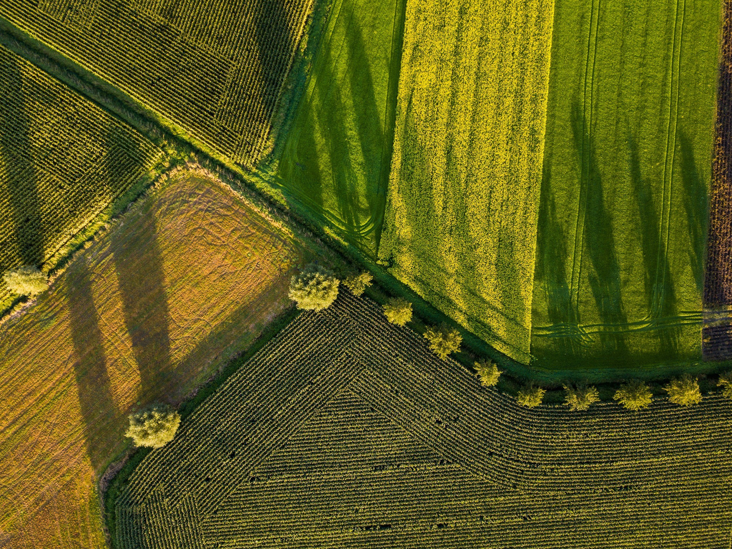
Aerial Imaging and Mapping: Drones can create detailed maps of farmland using RGB, multispectral, and hyper-spectral imagery. These maps reveal patterns not visible at ground level, such as plant stress or uneven irrigation.
Crop Monitoring: By flying over fields regularly, drones can monitor crop health over time, detecting early signs of disease, pest infestation, or nutrient deficiencies.
Soil and Field Analysis: Drone surveys provide 3D maps that help analyse soil condition, moisture levels, and topography, guiding efficient irrigation and planting strategies.
3. How Ecosense uses drone technology and data analytics to support smarter, more efficient farming.
Our precision farming surveys use high-resolution and multispectral imagery to monitor crop health, soil condition, and land use patterns. By identifying issues like nutrient deficiencies, pest pressure, or water stress early, we help you make targeted decisions that save input costs and boost yields—while protecting the environment.
We provide:
NDVI Crop Health Mapping – detect stressed areas and track performance over time
Soil & Drainage Analysis – spot compaction, erosion, and water retention issues
Variable Rate Application Support – map out where to apply fertilisers or treatments more effectively
Precision farming means doing more with less—and Ecosense gives you the tools to make every hectare count.
4. Benefits of Ecosense Surveys and Reporting
When combined, drones and AI bring synergistic advantages to precision agriculture:
Increased Efficiency: Automating field surveys and data analysis saves time and labor while improving accuracy.
Resource Optimisation: Targeted application of water, fertiliser, and pesticides reduces input costs and environmental impact.
Improved Crop Yields: Early detection of issues and data-driven decision-making leads to healthier crops and higher yields.
Sustainability: Reducing chemical usage, conserving water, and minimising soil erosion contribute to more environmentally friendly farming practices.